Water play and swimming for kids in Hobart & Southern Tasmania

61 places to cool off across the region: water parks, pools, beaches, lakes and swimming spots, nearest first from Hobart. Choose your suburb at the top to sort from where you are staying.

Everything on the map

Nearest first, from Hobart

Beaches and islands
Beach illustration
Beach
Short Beach
Sandy Bay
under 5 min
Beach illustration
Beach
Derwentwater Beach Reserve
Sandy Bay
under 5 min
Beach illustration
Beach
Red Chapel Beach
Sandy Bay
about 5 min
Beach illustration
Beach
Bellerive Beach
Bellerive
about 5 min
Beach illustration
Beach
Long Beach
Sandy Bay
about 5 min
Beach illustration
Beach
Nutgrove Beach
Sandy Bay
about 5 min
Beach illustration
Beach
Howrah Beach
Howrah
about 10 min
Beach illustration
Beach
Little Howrah Beach
Howrah
about 10 min
Beach illustration
Beach
Dixsons Beach
Taroona
about 10 min
Beach illustration
Beach
Hinsby Beach
Taroona
about 10 min
Beach illustration
Beach
Taroona Beach
Taroona
about 10 min
Kingston Beach
Beach
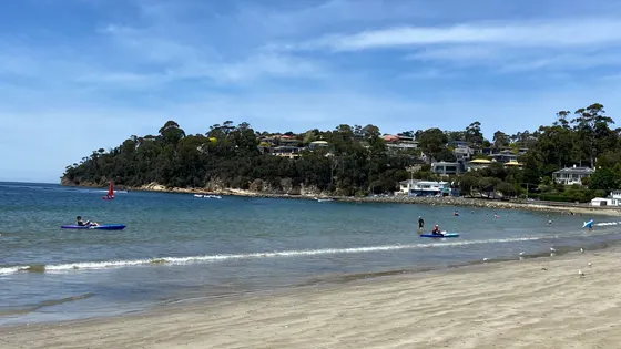
Kingston Beach
Long sandy beach with safe swimming areas; off-lead dog area at the northern end.
about 15 min
Photo: jacobharrisau, CC BY-SA 2.0
Beach illustration
Beach
Windermere Beach
Claremont
about 15 min
Beach illustration
Beach
Boronia Beach
Kingston Beach
about 20 min
Beach illustration
Beach
Mitchells Beach
Opossum Bay
about 20 min
Beach illustration
Beach
Blackmans Bay Beach
Blackmans Bay
about 20 min
Beach illustration
Beach
Opossum Bay Beach
Opossum Bay
about 20 min
Beach illustration
Beach
Roches Beach
Lauderdale
about 20 min
Beach illustration
Beach
Mays Beach
Sandford
about 25 min
Beach illustration
Beach
Mays Beach
Sandford
about 25 min
Seven Mile Beach
Beach
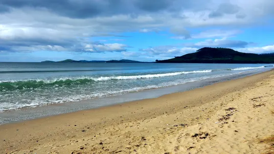
Seven Mile Beach
about 25 min
Photo: LBM1948, CC BY-SA 4.0
Beach illustration
Beach
South Arm Beach
South Arm
about 25 min
Beach illustration
Beach
Fort Beach
South Arm
about 25 min
Beach illustration
Beach
Penna Beach
Midway Point
about 25 min
Beach illustration
Beach
Hope Beach
South Arm
about 25 min
Beach illustration
Beach
Pot Beach
South Arm
about 25 min
Beach illustration
Beach
Tinderbox Beach
Tinderbox
about 25 min
Beach illustration
Beach
Calverts Beach
Sandford
about 30 min
Beach illustration
Beach
Clifton Beach
Clifton Beach
about 30 min
Beach illustration
Beach
Jetty Beach
Dennes Point
about 30 min
Beach illustration
Beach
Nebraska Beach
Dennes Point
about 30 min
Beach illustration
Beach
Snug Beach
Snug
about 30 min
Beach illustration
Beach
Coningham Beach
Coningham
about 30 min
Beach illustration
Beach
Legacy Beach
Coningham
about 30 min
Beach illustration
Beach
Little Coningham Beach
Coningham
about 30 min
Beach illustration
Beach
Nebraska Beach
Dennes Point
about 30 min
Beach illustration
Beach
Langfords Beach
North Bruny
about 30 min
Beach illustration
Beach
Red Ochre Beach
Dodges Ferry
about 30 min
Over 30 minutes
from Hobart
Beach illustration
Beach
Primrose Beach
Primrose Sands
about 35 min
Beach illustration
Beach
Sloping Main
Sloping Main
about 40 min
Beach illustration
Beach
Roaring Beach
Nubeena
about 45 min
Beach illustration
Beach
Middleton Beach
Middleton
about 45 min
Beach illustration
Beach
Carlisle Beach
Murdunna
about 50 min
Beach illustration
Beach
Dalton's Beach
Murdunna
about 50 min
Beach illustration
Beach
Dunalley Beach
Dunalley
about 50 min
Beach illustration
Beach
Dip Beach
Lymington
about 50 min
Beach illustration
Beach
Drip Beach
Lymington
about 50 min
Beach illustration
Beach
Sommers Beach
Murdunna
about 50 min
Beach illustration
Beach
White Beach
White Beach
about 50 min
Beach illustration
Beach
Pickup Beach
Verona Sands
about 55 min
Beach illustration
Beach
Big Roaring Beach
Surveyors Bay
about 55 min
Tessellated Pavement
Beach
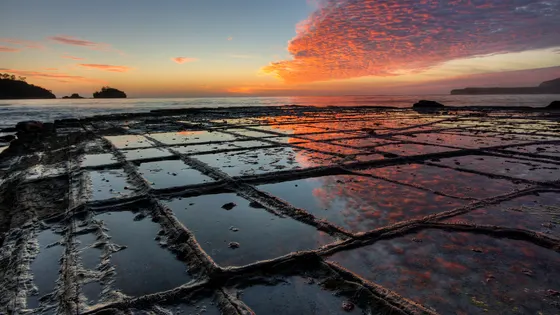
Tessellated Pavement
Tessellated Pavement State Reserve
Best at or near low tide; the rock is slippery when wet.
about 60 min
Photo: JJ Harrison (https://www.jjharrison.com.au/), CC BY-SA 2.5
Drive times are estimated from the distance, so treat them as a guide. Tap a card for the full page.
Region boundary: ABS Tourism Regions 2021 (Tourism Research Australia), CC BY 4.0. Outings from OpenStreetMap contributors (ODbL) and venues' own listings; nature spots from OpenStreetMap and park services.