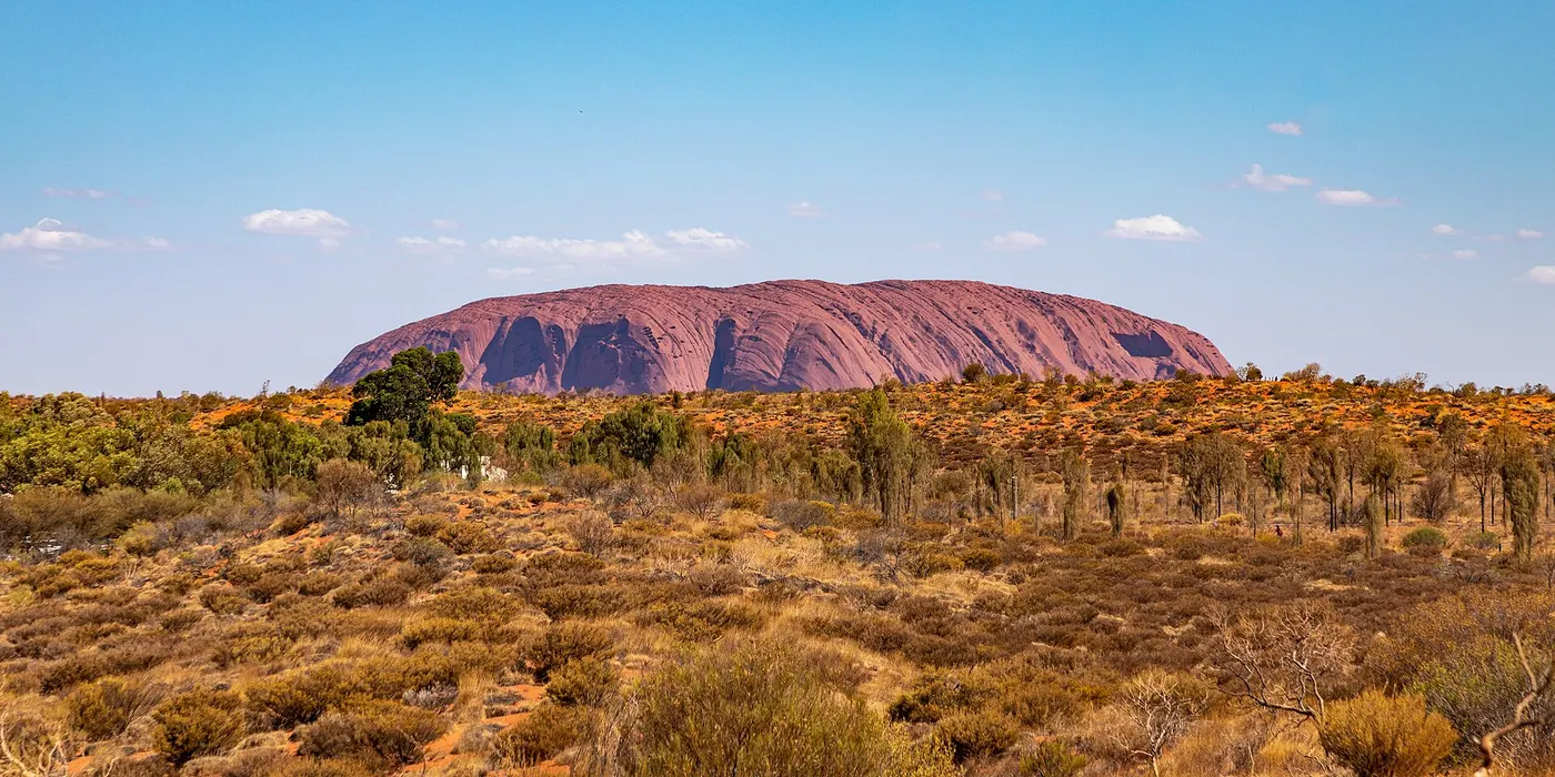
Camping in Lasseter
8 campgrounds · 3 with powered sites · 2 with showers · 4 with tent sites
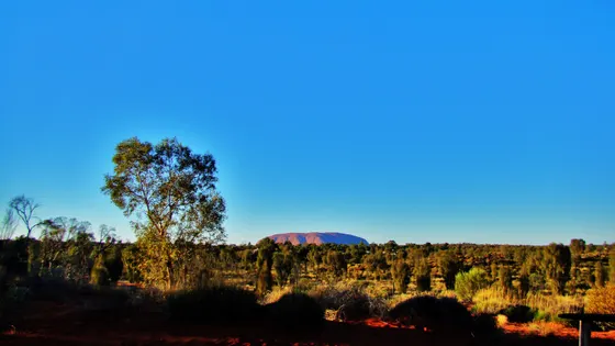
Lasseter is Uluru and Kata Tjuta country, in the red centre about 440 km south-west of Alice Springs. Uluru rises 348 metres from the plain, Kata Tjuta is a group of 36 rock domes, and the park is run jointly by Parks Australia and the Anangu traditional owners, who have lived here for more than 10,000 years. Climbing Uluru has been banned since October 2019.
Where is the best place to camp in Lasseter?
There is no camping inside Uluru-Kata Tjuta National Park, so for Uluru you stay in Yulara, the resort town about 18 km from the rock, where the Ayers Rock Campground has powered and unpowered sections. If you are also going to Kings Canyon, Kings Canyon Resort and Kings Creek Station both have powered sites, and along the Lasseter Highway, Curtin Springs is a rest stop.
What is there to do in Lasseter with kids?
The Uluru Base Walk circles the rock at ground level and suits a range of fitness levels, and the shorter Mala and Kuniya walks take in rock art and Anangu stories. The park has 73 reptile species, so keep an eye out for lizards on the paths. On the drive in, the Emu zoo is next to Desert Oaks.
What are the best walks and lookouts in Lasseter?
At Kata Tjuta, the Valley of the Winds walk is steep and rocky in places, with two lookouts, and closes in extreme heat. Around Uluru there are lookouts, including a sunrise lookout.
When is the best time to go camping in Lasseter?
Summer days here can pass 45°C, with UV readings of 11 to 15, so walk early and carry plenty of water, and pack warm clothes for winter nights that can drop to around -5°C.
Are there powered sites in Lasseter?
Yes. 3 campgrounds here have powered sites confirmed: Ayers Rock Campground - Unpowered Section, Kings Creek Station and Kings Canyon Resort. For the rest we are still confirming, so check with the park or holiday park before you book a powered site.
How far is Uluru from Alice Springs?
Uluru is about 440 km south-west of Alice Springs by road, roughly a five-hour drive, and Yulara is 428 km. You can also fly into Ayers Rock Airport, about 6 km north of Yulara, which has flights to Sydney, Melbourne and Cairns.
Facts from Wikipedia, "Uluru-Kata Tjuta National Park" (CC BY-SA 4.0) and Wikipedia, "Yulara" (CC BY-SA 4.0).
Ayers Rock Campground - Powered Section · Photo: Dietmar Rabich, CC BY-SA 4.0, via Wikimedia Commons
Map of campgrounds in Lasseter
✓ Campgrounds
✓ Walks and nature
More around NT
8 campgrounds
Those with the most confirmed facilities first. A missing facility means nobody has confirmed it, not that it is absent.
Campground · Yulara, NT
Ayers Rock Campground - Unpowered Section
Powered sites · Tent sites · Caravan and RV sites · Showers · Toilets · Drinking water · Wi-Fi · Wheelchair-accessible paths
Ayers Rock Campground - Unpowered Section is a campground in Yulara, NT. OpenStreetMap records 8 facilities. Check availability and current conditions before you travel.
Campground · Yulara, NT
Ayers Rock Campground - Powered Section
Caravan and RV sites · Showers · Toilets
Ayers Rock Campground - Powered Section is a caravan park in Yulara, NT. OpenStreetMap records 3 facilities. Check availability and current conditions before you travel.
Campground · Yulara, NT
Ayers Rock Campground Overflow
Tent sites · Caravan and RV sites · Wheelchair-accessible paths
Ayers Rock Campground Overflow is a campground in Yulara, NT. OpenStreetMap records 3 facilities. Check availability and current conditions before you travel.
Campground · Petermann, NT
Kings Creek Station
Powered sites · Tent sites · Caravan and RV sites
Kings Creek Station is a campground near Petermann, NT. OpenStreetMap records 3 facilities. Check availability and current conditions before you travel.
Campground · Petermann, NT
Kings Canyon Resort
Powered sites · Tent sites
Kings Canyon Resort is a caravan park in Petermann, NT. OpenStreetMap records 2 facilities. Check availability and current conditions before you travel.
Campground · Petermann, NT
Curtin Springs East RA
No facilities confirmed yet.
Curtin Springs East RA is a campground near Petermann, NT. OpenStreetMap records 0 facilities. Check availability and current conditions before you travel.
Campground · Ghan, NT
Desert Oaks Resort
No facilities confirmed yet.
Desert Oaks Resort is a caravan park in Ghan, NT. Its facilities have not been confirmed. Check availability and current conditions before you travel.
Campground · Kaltukatjara, NT
Kaltukatjara Campground
No facilities confirmed yet.
Kaltukatjara Campground is a campground near Kaltukatjara, NT. OpenStreetMap records 0 facilities. Check availability and current conditions before you travel.
Other regions in Northern Territory
Region boundary: ABS ASGS Edition 3 Tourism Regions 2021 (Tourism Research Australia), CC BY 4.0. Campgrounds and facilities from OpenStreetMap contributors (ODbL), the operators’ own listings, and the state park services’ open data: © State Government of NSW and NSW Department of Climate Change, Energy, the Environment and Water 2017 (CC BY 4.0); contains data sourced from the Department of Energy, Environment and Climate Action, Victoria (CC BY 4.0); © State of Tasmania, Parks and Wildlife Service (CC BY 3.0 AU); Main Roads Western Australia road stopping places (CC BY 4.0).