Camping in Central NSW
108 campgrounds · 17 with powered sites · 10 with showers · 9 with a dump point · 33 with tent sites
Central NSW is gold country, star country and zoo country all at once. Bathurst, founded in 1815, is the oldest inland British settlement in Australia and saw the first payable gold in 1851; the Warrumbungles became Australia's first certified Dark Sky Park in 2016; and Dubbo's open-range zoo is one of the best-known family outings in the state.
Where is the best place to camp in Central NSW?
It helps to pick a base. Around Bathurst, NRMA Bathurst Panorama Holiday Park is the main holiday park, and out at Hill End, about 75 km away, the Village Campground sits in the old gold town itself. Dubbo, Orange and Mudgee each have town parks within reach of their main sights. In the north, Warrumbungle National Park has its vehicle camps at Camp Blackman and others, and Coolah Tops has simple camps up on the plateau.
What is there to do in Central NSW with kids?
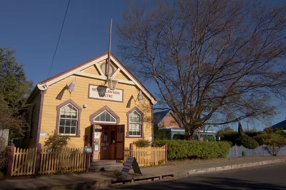
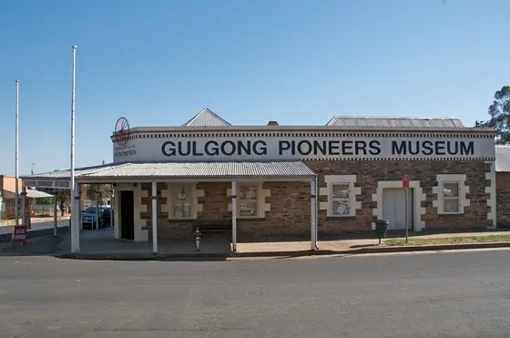
In Dubbo, Taronga Western Plains Zoo is an open-range zoo with white, black and Indian rhinos, and the Old Dubbo Gaol is in the middle of town. At Parkes, the Dish, a 64-metre radio telescope that helped relay the Apollo 11 moon landing, is about 20 km north of town. In Bathurst, the National Motor Racing Museum sits at Mount Panorama. Hill End is managed as a historic site, where Bernhardt Holtermann found the largest specimen of native gold ever discovered in 1872, and in Gulgong, the Holtermann Museum carries his name.
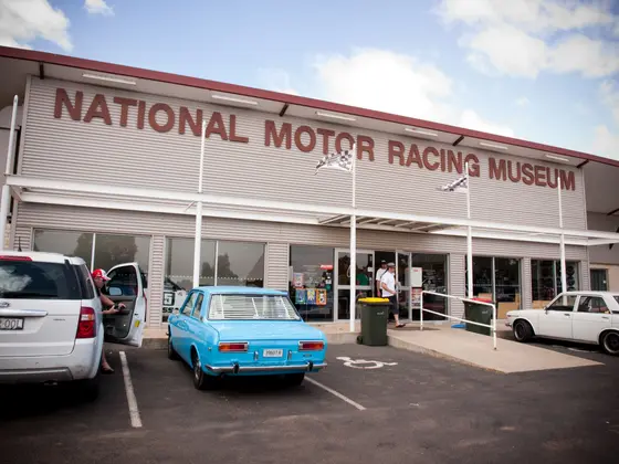
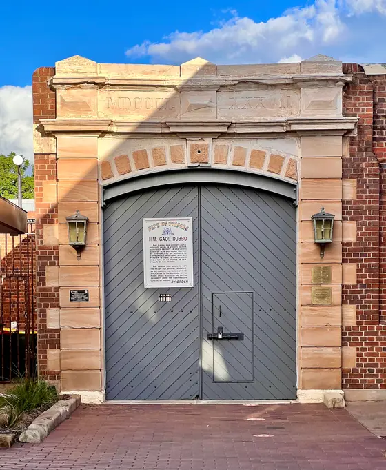
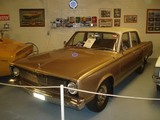
Tap a card for the full page. Every outing is on the map below too. Distances are in a straight line, so the drive is a little longer.
What are the best walks and waterfalls in Central NSW?
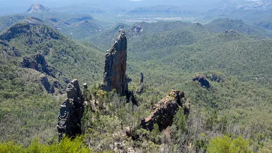
In the Warrumbungles, the Grand High Tops track gives views of The Breadknife and Belougery Spire, and the dark skies are made for stargazing, with Siding Spring Observatory next to the park. Near Orange, Mount Canobolas, an extinct volcano and the highest peak in the Central Tablelands at 1,397 metres, has walking tracks to Bald Hill, and Federal Falls has cliffs and cascading water. Coolah Tops has waterfalls that drop off the plateau, giant grass trees and snow gums.

Do you need to book campsites in Central NSW?
For the national parks, yes: Warrumbungle's hut and gated camping needs a permit through the visitor centre. Mount Panorama camping gets busy around the Bathurst 1000 in October and the 12 Hour in February, so check race dates before you book there.
Are there powered sites in Central NSW?
Yes. 17 campgrounds here have powered sites confirmed, including Village Campground, Tottenham Caravan Park and Camp Blackman 2. For the rest we are still confirming, so check with the park or holiday park before you book a powered site.
How far is Bathurst from Sydney?
Bathurst is about 203 km west-north-west of Sydney, Parkes about 355 km, Dubbo about 400 km by road, and Warrumbungle National Park about 550 km north-west.
Facts from Wikipedia, "Bathurst, New South Wales" (CC BY-SA 4.0), Wikipedia, "Hill End, New South Wales" (CC BY-SA 4.0), Wikipedia, "Warrumbungle National Park" (CC BY-SA 4.0), Wikipedia, "Dubbo" (CC BY-SA 4.0), Wikipedia, "Parkes, New South Wales" (CC BY-SA 4.0), Wikipedia, "Mount Canobolas" (CC BY-SA 4.0) and Wikipedia, "Coolah Tops National Park" (CC BY-SA 4.0).
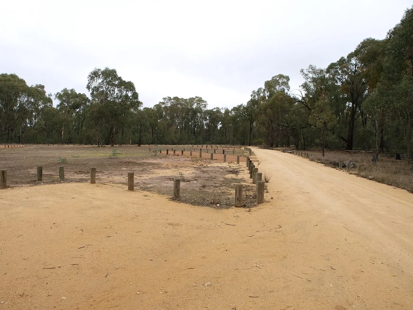
Wanda Wandong campground · Photo: D0a5l0e6, CC BY-SA 4.0, via Wikimedia Commons
Map of campgrounds in Central NSW
✓ Campgrounds
✓ Things to do
✓ Walks and nature
More around NSW
Camping in the Blue Mountains →
Camping in Capital Country →
Camping in the Central Coast →
Camping in the Hunter →
Camping in New England North West →
Camping in North Coast NSW →
Camping in Outback NSW →
Camping in the Riverina →
Camping in the Snowy Mountains →
Camping in the South Coast →
Camping in Sydney →
Camping on the Murray →
108 campgrounds
Those with the most confirmed facilities first. A missing facility means nobody has confirmed it, not that it is absent.
Campground · Hill End, NSW
Village Campground
Powered sites · Tent sites · Caravan and RV sites · Showers · Toilets · Dump point · Barbecues
Village Campground is a campground in Hill End, NSW. OpenStreetMap records 7 facilities. Check availability and current conditions before you travel.
Campground · Tottenham, NSW
Tottenham Caravan Park
Powered sites · Tent sites · Caravan and RV sites · Showers · Toilets · Dump point · Camp kitchen · Laundry
Tottenham Caravan Park is a caravan park in Tottenham, NSW. OpenStreetMap records 8 facilities. Check availability and current conditions before you travel.
Campground · Warrumbungle, NSW
Camp Blackman 1
Tent sites · Caravan and RV sites · Showers · Toilets · Barbecues
Camp Blackman 1 is a campground in Warrumbungle, NSW. OpenStreetMap records 4 facilities. Check availability and current conditions before you travel.
Campground · Warrumbungle, NSW
Camp Blackman 2
Powered sites · Tent sites · Caravan and RV sites · Toilets · Barbecues
Camp Blackman 2 is a campground in Warrumbungle, NSW. OpenStreetMap records 4 facilities. Check availability and current conditions before you travel.
Campground · Warrumbungle, NSW
Camp Blackman 3
Powered sites · Tent sites · Caravan and RV sites · Toilets · Barbecues
Camp Blackman 3 is a campground in Warrumbungle, NSW. OpenStreetMap records 4 facilities. Check availability and current conditions before you travel.
Campground · Parkes, NSW
Parkes Cabins
Powered sites · Tent sites · Caravan and RV sites · Showers · Toilets · Dump point · Drinking water
Parkes Cabins is a campground in Parkes, NSW. OpenStreetMap records 7 facilities. Check availability and current conditions before you travel.
Campground · Gilgandra, NSW
Gilgandra Caravan Park
Powered sites · Tent sites · Showers · Toilets · Dump point · Drinking water
Gilgandra Caravan Park is a caravan park in Gilgandra, NSW. OpenStreetMap records 6 facilities. Check availability and current conditions before you travel.
Campground · Baldry, NSW
Greenbah Creek campground
Tent sites · Caravan and RV sites · Toilets · Barbecues
Greenbah Creek campground is a campground near Baldry, NSW, listed by NSW National Parks and Wildlife Service (2017 listing). Check availability and current conditions before you travel.
Campground · Obley, NSW
Wanda Wandong campground
Tent sites · Caravan and RV sites · Toilets · Barbecues
Wanda Wandong campground is a campground near Obley, NSW, listed by NSW National Parks and Wildlife Service (2017 listing). Check availability and current conditions before you travel.
Campground · Warrumbungle, NSW
Camp Walaay
Powered sites · Tent sites · Caravan and RV sites · Barbecues
Camp Walaay is a campground in Warrumbungle, NSW. OpenStreetMap records 3 facilities. Check availability and current conditions before you travel.
Campground · Cowra, NSW
Cowra Showground Caravan Park
Powered sites · Caravan and RV sites · Showers · Toilets · Dump point
Cowra Showground Caravan Park is a campground in Cowra, NSW. OpenStreetMap records 5 facilities. Check availability and current conditions before you travel.
Campground · Kelgoola, NSW
Ganguddy-Dunns Swamp campground
Tent sites · Caravan and RV sites · Toilets · Barbecues
Ganguddy-Dunns Swamp campground is a campground in Kelgoola, NSW. OpenStreetMap records 3 facilities. Check availability and current conditions before you travel.
Campground · Coolah, NSW
The Barracks campground
Caravan and RV sites · Toilets · Barbecues
The Barracks campground is a campground near Coolah, NSW, listed by NSW National Parks and Wildlife Service (2017 listing). Check availability and current conditions before you travel.
Campground · Dunedoo, NSW
Dunedoo Caravan Park
Powered sites · Caravan and RV sites · Showers · Toilets
Dunedoo Caravan Park is a campground in Dunedoo, NSW. OpenStreetMap records 4 facilities. Check availability and current conditions before you travel.
Campground · Grenfell, NSW
Grenfell Caravan Park
Powered sites · Showers · Toilets · Pets allowed
Grenfell Caravan Park is a caravan park in Grenfell, NSW. OpenStreetMap records 4 facilities. Check availability and current conditions before you travel.
Campground · Coonabarabran, NSW
John Oxley Caravan Park
Powered sites · Toilets · Dump point · Drinking water
John Oxley Caravan Park is a caravan park in Coonabarabran, NSW. OpenStreetMap records 4 facilities. Check availability and current conditions before you travel.
Campground · Trangie, NSW
Trangie Caravan Park
Tent sites · Caravan and RV sites · Showers · Toilets
Trangie Caravan Park is a campground in Trangie, NSW. OpenStreetMap records 4 facilities. Check availability and current conditions before you travel.
Campground · Piney Range, NSW
Ben Hall campground
Barbecues
Ben Hall campground is a campground near Piney Range, NSW, listed by NSW National Parks and Wildlife Service (2017 listing). Check availability and current conditions before you travel.
Campground · Warrumbungle, NSW
Camp Wambelong
Barbecues
Camp Wambelong is a campground in Warrumbungle, NSW. Its facilities have not been confirmed. Check availability and current conditions before you travel.
Campground · Coolah, NSW
Coolah Home Base and Caravan Park
Powered sites · Tent sites · Camp kitchen
Coolah Home Base and Caravan Park is a caravan park in Coolah, NSW. OpenStreetMap records 3 facilities. Check availability and current conditions before you travel.
Campground · Coolah, NSW
Cox's Creek campground
Toilets · Barbecues
Cox's Creek campground is a campground near Coolah, NSW, listed by NSW National Parks and Wildlife Service (2017 listing). Check availability and current conditions before you travel.
Campground · Baradine, NSW
Dandry Gorge campground
Barbecues
Dandry Gorge campground is a campground near Baradine, NSW, listed by NSW National Parks and Wildlife Service (2017 listing). Check availability and current conditions before you travel.
Campground · Canobolas, NSW
Federal Falls Camping Area
Barbecues
Federal Falls Camping Area is a campground in Canobolas, NSW. Its facilities have not been confirmed. Check availability and current conditions before you travel.
Campground · Eugowra, NSW
Nangar campground
Barbecues
Nangar campground is a campground near Eugowra, NSW, listed by NSW National Parks and Wildlife Service (2017 listing). Check availability and current conditions before you travel.
Campground · Dubbo, NSW
NRMA Dubbo City Holiday Park
Powered sites · Dump point · Wi-Fi
NRMA Dubbo City Holiday Park is a caravan park in Dubbo, NSW. OpenStreetMap records 3 facilities. Check availability and current conditions before you travel.
Campground · Yarrabin, NSW
Reflections Cudgegong River Holiday Park
Tent sites · Caravan and RV sites · Dump point
Reflections Cudgegong River Holiday Park is a campground in Yarrabin, NSW. OpenStreetMap records 3 facilities. Check availability and current conditions before you travel.
Campground · Abercrombie River, NSW
Abercrombie Access campground
Barbecues
Abercrombie Access campground is a campground near Abercrombie River, NSW, listed by NSW National Parks and Wildlife Service (2017 listing). Check availability and current conditions before you travel.
Campground · Albert, NSW
Albert Park Rest Area
Showers · Toilets
Albert Park Rest Area is a campground in Albert, NSW. OpenStreetMap records 2 facilities. Check availability and current conditions before you travel.
Campground · Bruinbun, NSW
Amy Anderson Reserve
Tent sites · Toilets
Amy Anderson Reserve is a campground in Bruinbun, NSW. OpenStreetMap records 2 facilities. Check availability and current conditions before you travel.
Campground · Mogo, NSW
Big River campground
Barbecues
Big River campground is a campground near Mogo, NSW, listed by NSW National Parks and Wildlife Service (2017 listing). Check availability and current conditions before you travel.
Campground · Bruinbun, NSW
Black Gate Reserve
Tent sites · Toilets
Black Gate Reserve is a campground near Bruinbun, NSW. OpenStreetMap records 2 facilities. Check availability and current conditions before you travel.
Campground · Coolah, NSW
Brackens Hut campground
Barbecues
Brackens Hut campground is a campground near Coolah, NSW, listed by NSW National Parks and Wildlife Service (2017 listing). Check availability and current conditions before you travel.
Campground · Bruinbun, NSW
Bruinbun Reserve
Tent sites · Toilets
Bruinbun Reserve is a campground in Bruinbun, NSW. OpenStreetMap records 2 facilities. Check availability and current conditions before you travel.
Campground · Orange, NSW
Canobolas Caravan Park
Powered sites · Tent sites
Canobolas Caravan Park is a caravan park in Orange, NSW. OpenStreetMap records 2 facilities. Check availability and current conditions before you travel.
Campground · Cowra, NSW
Cowra Van Park
Tent sites · Caravan and RV sites
Cowra Van Park is a campground in Cowra, NSW. OpenStreetMap records 2 facilities. Check availability and current conditions before you travel.
Campground · Forbes, NSW
Forbes River Meadows Caravan Park
Powered sites · Tent sites
Forbes River Meadows Caravan Park is a caravan park in Forbes, NSW. OpenStreetMap records 2 facilities. Check availability and current conditions before you travel.
Campground · Hill End, NSW
Glendora campground
Barbecues
Glendora campground is a campground near Hill End, NSW, listed by NSW National Parks and Wildlife Service (2017 listing). Check availability and current conditions before you travel.
Campground · Gulargambone, NSW
Gulargambone Caravan Park
Powered sites · Dump point
Gulargambone Caravan Park is a caravan park in Gulargambone, NSW. OpenStreetMap records 2 facilities. Check availability and current conditions before you travel.
Campground · Piney Range, NSW
Holy campground
Barbecues
Holy campground is a campground near Piney Range, NSW, listed by NSW National Parks and Wildlife Service (2017 listing). Check availability and current conditions before you travel.
Campground · Munghorn, NSW
Honeyeater Flat Camping E
Barbecues
Honeyeater Flat Camping E is a campground near Munghorn, NSW, listed by NSW National Parks and Wildlife Service (2017 listing). Check availability and current conditions before you travel.
Campground · Bruinbun, NSW
Johnsons Hole Reserve
Tent sites · Toilets
Johnsons Hole Reserve is a campground in Bruinbun, NSW. OpenStreetMap records 2 facilities. Check availability and current conditions before you travel.
Campground · Bruinbun, NSW
Randwick Hole Reserve
Tent sites · Toilets
Randwick Hole Reserve is a campground in Bruinbun, NSW. OpenStreetMap records 2 facilities. Check availability and current conditions before you travel.
Campground · Mumbil, NSW
Reflections Lake Burrendong - Holiday Park
Tent sites · Caravan and RV sites
Reflections Lake Burrendong - Holiday Park is a campground in Mumbil, NSW. OpenStreetMap records 2 facilities. Check availability and current conditions before you travel.
Campground · Mogo, NSW
Spring Gully campground
Barbecues
Spring Gully campground is a campground near Mogo, NSW, listed by NSW National Parks and Wildlife Service (2017 listing). Check availability and current conditions before you travel.
Campground · Bruinbun, NSW
Tattersalls Hole Reserve
Tent sites · Toilets
Tattersalls Hole Reserve is a campground in Bruinbun, NSW. OpenStreetMap records 2 facilities. Check availability and current conditions before you travel.
Campground · Coolah, NSW
The Pines Camping Area
Toilets · Barbecues
The Pines Camping Area is a campground in Coolah, NSW. OpenStreetMap records 1 facility. Check availability and current conditions before you travel.
Campground · Crudine, NSW
Wallaby Rocks Campground
Tent sites · Caravan and RV sites
Wallaby Rocks Campground is a campground in Crudine, NSW. OpenStreetMap records 2 facilities. Check availability and current conditions before you travel.
Campground · Warrumbungle, NSW
Balor Hut camp
Barbecues
Balor Hut camp is a campground near Warrumbungle, NSW, listed by NSW National Parks and Wildlife Service (2017 listing). Check availability and current conditions before you travel.
Campground · Windeyer, NSW
Bushlands Tourist Park
Caravan and RV sites
Bushlands Tourist Park is a campground in Windeyer, NSW. OpenStreetMap records 1 facility. Check availability and current conditions before you travel.
Campground · Bruinbun, NSW
Cave Hole Reserve
Tent sites
Cave Hole Reserve is a campground near Bruinbun, NSW. OpenStreetMap records 1 facility. Check availability and current conditions before you travel.
Campground · Orange, NSW
Colour City Caravan Park
Tent sites
Colour City Caravan Park is a caravan park in Orange, NSW. OpenStreetMap records 1 facility. Check availability and current conditions before you travel.
Campground · Warrumbungle, NSW
Danu camp
Barbecues
Danu camp is a campground near Warrumbungle, NSW, listed by NSW National Parks and Wildlife Service (2017 listing). Check availability and current conditions before you travel.
Campground · Dubbo, NSW
Discovery Parks - Dubbo
Tent sites
Discovery Parks - Dubbo is a caravan park in Dubbo, NSW. OpenStreetMap records 1 facility. Check availability and current conditions before you travel.
Campground · Bruinbun, NSW
Grimleys Hotel Reserve
Tent sites
Grimleys Hotel Reserve is a campground in Bruinbun, NSW. OpenStreetMap records 1 facility. Check availability and current conditions before you travel.
Campground · Warrumbungle, NSW
Hurleys camp
Barbecues
Hurleys camp is a campground near Warrumbungle, NSW, listed by NSW National Parks and Wildlife Service (2017 listing). Check availability and current conditions before you travel.
Campground · Bruinbun, NSW
Mary Flynn Reserve
Tent sites
Mary Flynn Reserve is a campground in Bruinbun, NSW. OpenStreetMap records 1 facility. Check availability and current conditions before you travel.
Campground · Molong, NSW
Molong Caravan Park
Tent sites
Molong Caravan Park is a caravan park in Molong, NSW. OpenStreetMap records 1 facility. Check availability and current conditions before you travel.
Campground · Bruinbun, NSW
Native Dog Reserve
Tent sites
Native Dog Reserve is a campground near Bruinbun, NSW. OpenStreetMap records 1 facility. Check availability and current conditions before you travel.
Campground · Warrumbungle, NSW
Ogma Saddle camp
Barbecues
Ogma Saddle camp is a campground near Warrumbungle, NSW, listed by NSW National Parks and Wildlife Service (2017 listing). Check availability and current conditions before you travel.
Campground · Warrumbungle, NSW
Pincham camp
Pincham camp is a campground near Warrumbungle, NSW, listed by NSW National Parks and Wildlife Service (2017 listing). Check availability and current conditions before you travel.
Other regions in New South Wales
Region boundary: ABS ASGS Edition 3 Tourism Regions 2021 (Tourism Research Australia), CC BY 4.0. Campgrounds and facilities from OpenStreetMap contributors (ODbL), the operators’ own listings, and the state park services’ open data: © State Government of NSW and NSW Department of Climate Change, Energy, the Environment and Water 2017 (CC BY 4.0); contains data sourced from the Department of Energy, Environment and Climate Action, Victoria (CC BY 4.0); © State of Tasmania, Parks and Wildlife Service (CC BY 3.0 AU); Main Roads Western Australia road stopping places (CC BY 4.0).