Camping in New England North West
97 campgrounds · 16 with powered sites · 18 with showers · 13 with a dump point · 41 with tent sites
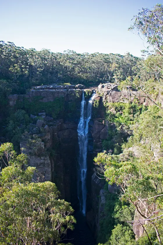
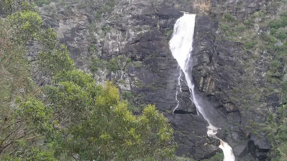
New England is high country. The tablelands towns sit around 1,000 metres up, so winters bring frost and the odd snowfall, and the rivers running east off the plateau have cut deep gorges, the Apsley, Wollomombi and Dangars among them. Wollomombi Falls, about 40 km east of Armidale, is one of the highest waterfalls in the country.
Where is the best place to camp in New England North West?
The camping splits between the tablelands towns and the national parks on the edge of the escarpment. In the towns, Armidale Tourist Park has powered sites and showers, and Uralla, Glen Innes, Tenterfield and Inverell each have caravan parks close to their museums. For the gorges, the national park camps sit right at the edge: east of Walcha, Apsley Gorge Campground is in Oxley Wild Rivers National Park. For water, Reflections Copeton Waters is a holiday park on a big lake, and the Gwydir River camps sit on the river near Bingara.
What is there to do in New England North West with kids?
Fossicking is the local pastime. Near Uralla, the Wooldridge fossicking area lends itself to a go at panning, and Uralla's McCrossin's Mill is in town. Around Nundle, founded after gold was found in 1852, you can pan for gold and sapphires in the Peel River, with the Gold Mine Museum close to the caravan park, and the creek valleys west of Glen Innes have gemstone fossicking too. Armidale is a cathedral city and university town, home to the University of New England.
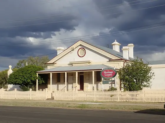
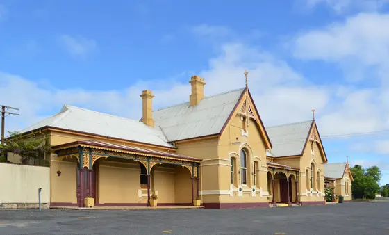
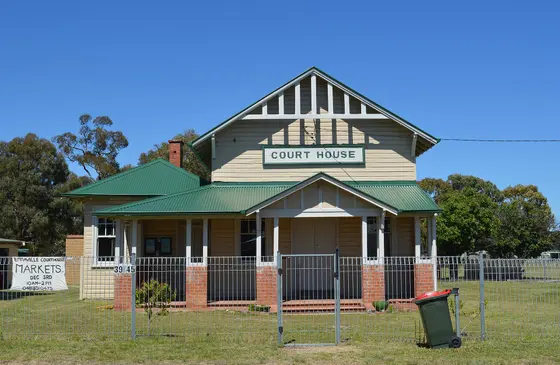
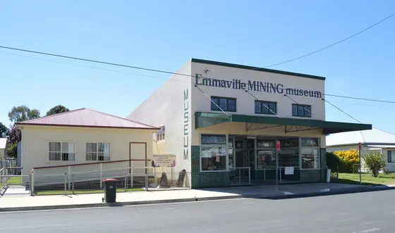
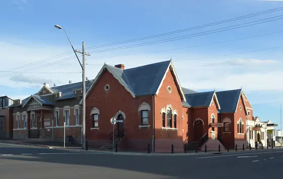
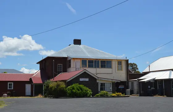
Tap a card for the full page. Every outing is on the map below too. Distances are in a straight line, so the drive is a little longer.
What are the best waterfalls and gorge walks in New England?
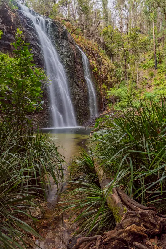
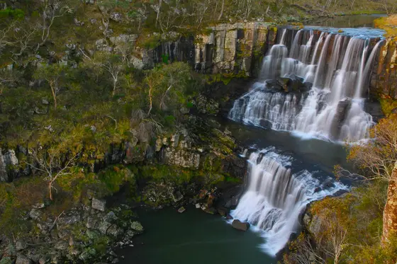
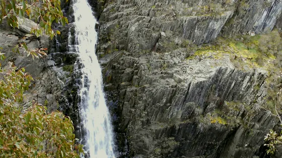
In Oxley Wild Rivers, Apsley Falls has a steel stairway down to a viewing deck and a 1.2 km rim walk, and the Tia Falls walk is 1.5 km return. In Gibraltar Range, Lyrebird Falls is a short walk from the Boundary Falls picnic area, and the Duffer Falls track is 7 km return for older kids, with lyrebirds and the Gibraltar Range waratah in spring. Near Ebor, the falls have a sealed, step-free path between the upper and lower lookouts.
When is the best time to go camping in New England North West?
Summer is the easy time. Glen Innes is one of the coldest towns in Australia outside the Snowy Mountains and Tasmania, and has dropped to -12.8°C, so pack for frost if you camp in winter.
Do you need to book campsites in New England North West?
Camping in Oxley Wild Rivers and the other national parks is booked through NSW National Parks and Wildlife Service.
Are there powered sites in New England North West?
Yes. 16 campgrounds here have powered sites confirmed, including Armidale Tourist Park, Gwydir Motel & Caravan Park and Inverell caravan Park. For the rest we are still confirming, so check with the park or holiday park before you book a powered site.
How far is Armidale from Sydney?
Armidale is about 485 km north-north-east of Sydney. Oxley Wild Rivers National Park is roughly 445 km, Nundle about 400 km, Gibraltar Range about 493 km and Glen Innes about 608 km by road.
Facts from Wikipedia, "Oxley Wild Rivers National Park" (CC BY-SA 4.0), Wikipedia, "Glen Innes, New South Wales" (CC BY-SA 4.0), Wikipedia, "Armidale, New South Wales" (CC BY-SA 4.0), Wikipedia, "Uralla, New South Wales" (CC BY-SA 4.0), Wikipedia, "Nundle, New South Wales" (CC BY-SA 4.0) and NSW National Parks and Wildlife Service, "Duffer Falls walking track".
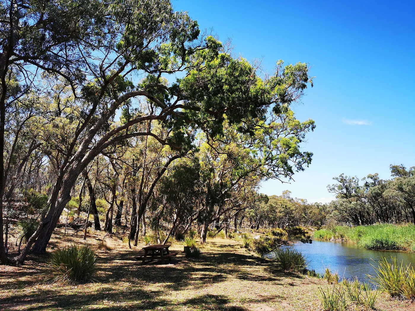
Kings Plains Creek Camping and Picnic Area · Photo: Margaret Donald, CC BY-SA 2.0, via Wikimedia Commons
Map of campgrounds in New England North West
✓ Campgrounds
✓ Things to do
✓ Walks and nature
More around NSW
Camping in the Blue Mountains →
Camping in Capital Country →
Camping in the Central Coast →
Camping in Central NSW →
Camping in the Hunter →
Camping in North Coast NSW →
Camping in Outback NSW →
Camping in the Riverina →
Camping in the Snowy Mountains →
Camping in the South Coast →
Camping in Sydney →
Camping on the Murray →
97 campgrounds
Those with the most confirmed facilities first. A missing facility means nobody has confirmed it, not that it is absent.
Campground · Armidale, NSW
Armidale Tourist Park
Powered sites · Tent sites · Caravan and RV sites · Showers · Toilets · Dump point · Camp kitchen · Laundry
Armidale Tourist Park is a campground in Armidale, NSW. OpenStreetMap records 10 facilities. Check availability and current conditions before you travel.
Campground · Moree, NSW
Gwydir Motel & Caravan Park
Powered sites · Tent sites · Caravan and RV sites · Showers · Toilets · Dump point · Drinking water · Camp kitchen
Gwydir Motel & Caravan Park is a campground in Moree, NSW. OpenStreetMap records 9 facilities. Check availability and current conditions before you travel.
Campground · Inverell, NSW
Inverell caravan Park
Powered sites · Tent sites · Caravan and RV sites · Showers · Toilets · Camp kitchen · Laundry
Inverell caravan Park is a campground in Inverell, NSW. OpenStreetMap records 7 facilities. Check availability and current conditions before you travel.
Campground · Deepwater, NSW
Kookaburra Camping & Caravan Park
Tent sites · Caravan and RV sites · Showers · Toilets · Dump point · Camp kitchen · Wheelchair-accessible paths
Kookaburra Camping & Caravan Park is a campground in Deepwater, NSW. OpenStreetMap records 7 facilities. Check availability and current conditions before you travel.
Campground · Gibraltar Range, NSW
Mulligans campground
Tent sites · Caravan and RV sites · Showers · Toilets · Barbecues
Mulligans campground is a campground near Gibraltar Range, NSW, listed by NSW National Parks and Wildlife Service (2017 listing). Check availability and current conditions before you travel.
Campground · Ashford, NSW
Ashford Caravan Park
Powered sites · Tent sites · Caravan and RV sites · Showers · Toilets · Dump point
Ashford Caravan Park is a campground in Ashford, NSW. OpenStreetMap records 6 facilities. Check availability and current conditions before you travel.
Campground · Boonoo Boonoo, NSW
Bald Rock campground
Tent sites · Caravan and RV sites · Toilets · Barbecues
Bald Rock campground is a campground near Boonoo Boonoo, NSW, listed by NSW National Parks and Wildlife Service (2017 listing). Check availability and current conditions before you travel.
Campground · Kaputar, NSW
Bark Hut Campground
Tent sites · Showers · Toilets · Barbecues
Bark Hut Campground is a campground in Kaputar, NSW. OpenStreetMap records 3 facilities. Check availability and current conditions before you travel.
Campground · Torrington, NSW
Blatherarm campground
Tent sites · Caravan and RV sites · Toilets · Barbecues
Blatherarm campground is a campground near Torrington, NSW, listed by NSW National Parks and Wildlife Service (2017 listing). Check availability and current conditions before you travel.
Campground · Boomi, NSW
Boomi Co-Op Caravan Park
Powered sites · Tent sites · Caravan and RV sites · Showers · Toilets · Dump point
Boomi Co-Op Caravan Park is a campground in Boomi, NSW. OpenStreetMap records 6 facilities. Check availability and current conditions before you travel.
Campground · Boomi, NSW
Boomi Co-Op Caravan Park - Overflow
Powered sites · Tent sites · Caravan and RV sites · Showers · Toilets · Dump point
Boomi Co-Op Caravan Park - Overflow is a campground in Boomi, NSW. OpenStreetMap records 6 facilities. Check availability and current conditions before you travel.
Campground · Uralla, NSW
Country Road Caravan Park
Powered sites · Tent sites · Toilets · Dump point · Pets allowed · Wi-Fi
Country Road Caravan Park is a caravan park in Uralla, NSW. OpenStreetMap records 6 facilities. Check availability and current conditions before you travel.
Campground · Boorook, NSW
Cypress Pine campground
Tent sites · Caravan and RV sites · Toilets · Barbecues
Cypress Pine campground is a campground near Boorook, NSW, listed by NSW National Parks and Wildlife Service (2017 listing). Check availability and current conditions before you travel.
Campground · Kaputar, NSW
Dawsons Spring Campground
Tent sites · Showers · Toilets · Barbecues
Dawsons Spring Campground is a campground in Kaputar, NSW. OpenStreetMap records 3 facilities. Check availability and current conditions before you travel.
Campground · Armidale, NSW
Highlander Van Village
Powered sites · Tent sites · Showers · Toilets · Dump point · Drinking water
Highlander Van Village is a caravan park in Armidale, NSW. OpenStreetMap records 6 facilities. Check availability and current conditions before you travel.
Campground · North Star, NSW
North Star Caravan Park
Powered sites · Tent sites · Caravan and RV sites · Showers · Toilets · Laundry
North Star Caravan Park is a campground in North Star, NSW. OpenStreetMap records 6 facilities. Check availability and current conditions before you travel.
Campground · Warialda, NSW
Warialda Caravan Park
Powered sites · Tent sites · Caravan and RV sites · Showers · Toilets · Laundry
Warialda Caravan Park is a campground in Warialda, NSW. OpenStreetMap records 6 facilities. Check availability and current conditions before you travel.
Campground · Boggabri, NSW
Boggabri Caravan Park
Powered sites · Tent sites · Showers · Toilets · Laundry
Boggabri Caravan Park is a caravan park in Boggabri, NSW. OpenStreetMap records 5 facilities. Check availability and current conditions before you travel.
Campground · Moogem, NSW
Boundary Falls campground
Tent sites · Caravan and RV sites · Toilets · Barbecues
Boundary Falls campground is a campground near Moogem, NSW, listed by NSW National Parks and Wildlife Service (2017 listing). Check availability and current conditions before you travel.
Campground · Gibraltar Range, NSW
Coombadjha camp
Tent sites · Toilets · Barbecues
Coombadjha camp is a campground near Gibraltar Range, NSW, listed by NSW National Parks and Wildlife Service (2017 listing). Check availability and current conditions before you travel.
Campground · Inverell, NSW
Fossickers Rest Caravan Park
Powered sites · Tent sites · Caravan and RV sites · Dump point · Camp kitchen
Fossickers Rest Caravan Park is a campground in Inverell, NSW. OpenStreetMap records 5 facilities. Check availability and current conditions before you travel.
Campground · Kings Plains, NSW
Ironbark Camping Area
Tent sites · Caravan and RV sites · Campfires allowed · Barbecues
Ironbark Camping Area is a campground in Kings Plains, NSW. OpenStreetMap records 3 facilities. Check availability and current conditions before you travel.
Campground · Kings Plains, NSW
Kings Plains Creek Camping and Picnic Area
Tent sites · Campfires allowed · Barbecues
Kings Plains Creek Camping and Picnic Area is a campground in Kings Plains, NSW. OpenStreetMap records 2 facilities. Check availability and current conditions before you travel.
Campground · Tingha, NSW
Tingha Gems Caravan Park
Tent sites · Caravan and RV sites · Showers · Toilets · Dump point
Tingha Gems Caravan Park is a campground in Tingha, NSW. OpenStreetMap records 5 facilities. Check availability and current conditions before you travel.
Campground · Hillgrove, NSW
Wollomombi Campground
Tent sites · Caravan and RV sites · Toilets · Campfires allowed · Barbecues
Wollomombi Campground is a campground in Hillgrove, NSW. OpenStreetMap records 4 facilities. Check availability and current conditions before you travel.
Campground · Walcha, NSW
Apsley Gorge Campground
Toilets · Barbecues
Apsley Gorge Campground is a campground in Walcha, NSW. OpenStreetMap records 1 facility. Check availability and current conditions before you travel.
Campground · Garah, NSW
Club Hotel Garah Freecamp
Tent sites · Caravan and RV sites · Showers · Toilets
Club Hotel Garah Freecamp is a campground in Garah, NSW. OpenStreetMap records 4 facilities. Check availability and current conditions before you travel.
Campground · Sandy Hill, NSW
Crooked Creek Rest Area
Tent sites · Caravan and RV sites · Toilets · Campfires allowed
Crooked Creek Rest Area is a campground near Sandy Hill, NSW. OpenStreetMap records 4 facilities. Check availability and current conditions before you travel.
Campground · Nundle, NSW
Fossickers Tourist Park
Tent sites · Caravan and RV sites · Showers · Toilets
Fossickers Tourist Park is a campground in Nundle, NSW. OpenStreetMap records 4 facilities. Check availability and current conditions before you travel.
Campground · Lindesay, NSW
Horton Falls Campground
Tent sites · Toilets · Barbecues
Horton Falls Campground is a campground in Lindesay, NSW. OpenStreetMap records 2 facilities. Check availability and current conditions before you travel.
Campground · Diehard, NSW
Mann River Campground & Picnic Area
Toilets · Barbecues
Mann River Campground & Picnic Area is a campground in Diehard, NSW. OpenStreetMap records 1 facility. Check availability and current conditions before you travel.
Campground · Keepit, NSW
Reflections Lake Keepit - Holiday Park
Tent sites · Caravan and RV sites · Showers · Toilets
Reflections Lake Keepit - Holiday Park is a campground in Keepit, NSW. OpenStreetMap records 4 facilities. Check availability and current conditions before you travel.
Campground · Uralla, NSW
Uralla Caravan Park
Powered sites · Tent sites · Toilets · Pets allowed
Uralla Caravan Park is a caravan park in Uralla, NSW. OpenStreetMap records 4 facilities. Check availability and current conditions before you travel.
Campground · Attunga, NSW
Attunga Camp Ground
Tent sites · Caravan and RV sites · Toilets
Attunga Camp Ground is a campground in Attunga, NSW. OpenStreetMap records 3 facilities. Check availability and current conditions before you travel.
Campground · Urbenville, NSW
Bandahngan (Tooloom Falls) campground
Barbecues
Bandahngan (Tooloom Falls) campground is a campground near Urbenville, NSW, listed by NSW National Parks and Wildlife Service (2017 listing). Check availability and current conditions before you travel.
Campground · Ebor, NSW
Barokee campground
Barbecues
Barokee campground is a campground near Ebor, NSW, listed by NSW National Parks and Wildlife Service (2017 listing). Check availability and current conditions before you travel.
Campground · Gibraltar Range, NSW
Bellbird campground
Barbecues
Bellbird campground is a campground near Gibraltar Range, NSW, listed by NSW National Parks and Wildlife Service (2017 listing). Check availability and current conditions before you travel.
Campground · Torrington, NSW
Blatherarm Camping Area 3
Tent sites · Caravan and RV sites · Toilets
Blatherarm Camping Area 3 is a campground near Torrington, NSW. OpenStreetMap records 3 facilities. Check availability and current conditions before you travel.
Campground · Walcha, NSW
Budds Mare campground
Barbecues
Budds Mare campground is a campground near Walcha, NSW, listed by NSW National Parks and Wildlife Service (2017 listing). Check availability and current conditions before you travel.
Campground · Warrabah, NSW
Gum Hole campground
Barbecues
Gum Hole campground is a campground near Warrabah, NSW, listed by NSW National Parks and Wildlife Service (2017 listing). Check availability and current conditions before you travel.
Campground · Atholwood, NSW
Kookibitta Campground
Barbecues
Kookibitta Campground is a campground in Atholwood, NSW. Its facilities have not been confirmed. Check availability and current conditions before you travel.
Campground · Yarrowitch, NSW
Mooraback Campground
Barbecues
Mooraback Campground is a campground in Yarrowitch, NSW. Its facilities have not been confirmed. Check availability and current conditions before you travel.
Campground · Ebor, NSW
Native Dog campground
Barbecues
Native Dog campground is a campground near Ebor, NSW, listed by NSW National Parks and Wildlife Service (2017 listing). Check availability and current conditions before you travel.
Campground · Yarrowitch, NSW
New Country Swamp campground
Barbecues
New Country Swamp campground is a campground near Yarrowitch, NSW, listed by NSW National Parks and Wildlife Service (2017 listing). Check availability and current conditions before you travel.
Campground · Walcha, NSW
Riverside campground
Barbecues
Riverside campground is a campground near Walcha, NSW, listed by NSW National Parks and Wildlife Service (2017 listing). Check availability and current conditions before you travel.
Campground · The Pilliga, NSW
Salt Caves campground
Barbecues
Salt Caves campground is a campground near The Pilliga, NSW, listed by NSW National Parks and Wildlife Service (2017 listing). Check availability and current conditions before you travel.
Campground · Nundle, NSW
Swamp Creek Reserve
Tent sites · Caravan and RV sites · Toilets
Swamp Creek Reserve is a campground in Nundle, NSW. OpenStreetMap records 3 facilities. Check availability and current conditions before you travel.
Campground · Tenterfield, NSW
Tenterfield Lodge & Caravan Park
Powered sites · Dump point · Wi-Fi
Tenterfield Lodge & Caravan Park is a caravan park in Tenterfield, NSW. OpenStreetMap records 3 facilities. Check availability and current conditions before you travel.
Campground · Ebor, NSW
Thungutti campground
Barbecues
Thungutti campground is a campground near Ebor, NSW, listed by NSW National Parks and Wildlife Service (2017 listing). Check availability and current conditions before you travel.
Campground · Yarrowitch, NSW
Tia Falls Campground
Barbecues
Tia Falls Campground is a campground in Yarrowitch, NSW. Its facilities have not been confirmed. Check availability and current conditions before you travel.
Campground · Walcha, NSW
Walcha Caravan Park
Powered sites · Dump point · Wi-Fi
Walcha Caravan Park is a caravan park in Walcha, NSW. OpenStreetMap records 3 facilities. Check availability and current conditions before you travel.
Campground · Warrabah, NSW
Warrabah campground
Barbecues
Warrabah campground is a campground near Warrabah, NSW, listed by NSW National Parks and Wildlife Service (2017 listing). Check availability and current conditions before you travel.
Campground · Rocky River, NSW
Wooldridge (Uralla) Fossicking Area
Tent sites · Caravan and RV sites · Toilets
Wooldridge (Uralla) Fossicking Area is a campground in Rocky River, NSW. OpenStreetMap records 3 facilities. Check availability and current conditions before you travel.
Campground · Yarrowyck, NSW
Yarrowyck Crossing
Tent sites · Caravan and RV sites · Toilets
Yarrowyck Crossing is a campground in Yarrowyck, NSW. OpenStreetMap records 3 facilities. Check availability and current conditions before you travel.
Campground · Dangarsleigh, NSW
Dangars Gorge campground
Barbecues
Dangars Gorge campground is a campground near Dangarsleigh, NSW, listed by NSW National Parks and Wildlife Service (2017 listing). Check availability and current conditions before you travel.
Campground · Dumaresq, NSW
Dumaresq Dam Tents
Tent sites · Toilets
Dumaresq Dam Tents is a campground in Dumaresq, NSW. OpenStreetMap records 2 facilities. Check availability and current conditions before you travel.
Campground · Dumaresq, NSW
Dumaresq Dam Vehicles
Caravan and RV sites · Toilets
Dumaresq Dam Vehicles is a campground in Dumaresq, NSW. OpenStreetMap records 2 facilities. Check availability and current conditions before you travel.
Campground · Moogem, NSW
Grassy Creek camp
Barbecues
Grassy Creek camp is a campground near Moogem, NSW, listed by NSW National Parks and Wildlife Service (2017 listing). Check availability and current conditions before you travel.
Campground · Jeogla, NSW
Halls Peak campground
Barbecues
Halls Peak campground is a campground near Jeogla, NSW, listed by NSW National Parks and Wildlife Service (2017 listing). Check availability and current conditions before you travel.
Campground · Bingara, NSW
Honeymoon - Gwydir River Camps
Tent sites · Caravan and RV sites
Honeymoon - Gwydir River Camps is a campground in Bingara, NSW. OpenStreetMap records 2 facilities. Check availability and current conditions before you travel.
Other regions in New South Wales
Region boundary: ABS ASGS Edition 3 Tourism Regions 2021 (Tourism Research Australia), CC BY 4.0. Campgrounds and facilities from OpenStreetMap contributors (ODbL), the operators’ own listings, and the state park services’ open data: © State Government of NSW and NSW Department of Climate Change, Energy, the Environment and Water 2017 (CC BY 4.0); contains data sourced from the Department of Energy, Environment and Climate Action, Victoria (CC BY 4.0); © State of Tasmania, Parks and Wildlife Service (CC BY 3.0 AU); Main Roads Western Australia road stopping places (CC BY 4.0).