Camping in the High Country
187 campgrounds · 3 with powered sites · 1 with a dump point · 26 with tent sites
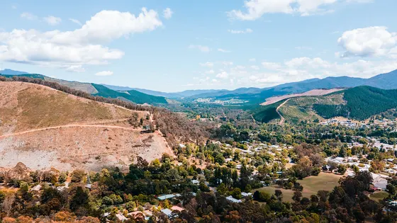
Victoria's High Country is mountains, rivers and old gold towns, and it is big enough that it helps to pick a valley first. Mount Bogong at 1,986 metres and Mount Feathertop at 1,922 metres, the state's two highest peaks, both rise near Bright, while Lake Eildon and Mansfield sit on the gentler western side.
Where is the best place to camp in the High Country?
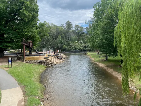
Around Bright and the Ovens Valley, about 317 km from Melbourne, there are plenty of parks close to the river and the rail trail, such as Bright Riverside Holiday Park. Around Lake Eildon and Mansfield there are holiday parks near the water, and Lake Eildon National Park has bush camps such as Devil Cove. In the north-east, Beechworth has Lake Sambell Caravan Park, and out along the Upper Murray there is a long string of small river camps near Walwa and Towong.
What is there to do in the High Country with kids?
The Murray to the Mountains Rail Trail runs 95 km through Bright, Myrtleford and Beechworth to Wangaratta, and the Ovens River is used for swimming in the warmer months. The Bright Museum is close to the parks, and platypus, wombats and lyrebirds live nearby. Beechworth still has its gold-rush buildings, including the courthouse linked to Ned Kelly's hearings, and the Old Beechworth Gaol and the Burke Museum are near town. Lake Eildon, formed by a dam first finished in 1929, is restocked with Murray cod and golden perch, so bring a rod. In Wangaratta, the Splashpark is in town.
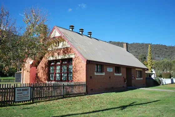
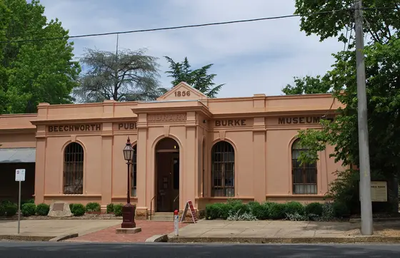
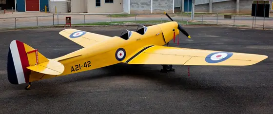
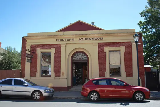
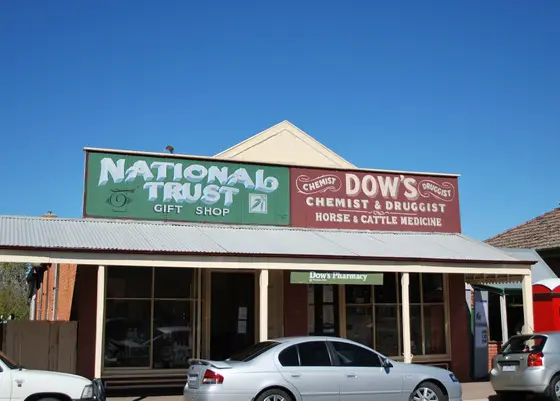
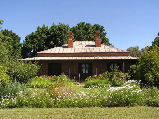
Tap a card for the full page. Every outing is on the map below too. Distances are in a straight line, so the drive is a little longer.
What are the best walks and waterfalls in the High Country?
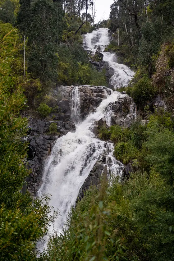
Around Bright, the walking tracks along Morses Creek and the Ovens River suit short or long walks. In Beechworth, the trails pass Spring Creek Gorge and its waterfalls, Woolshed Creek and the historic mining Tail Race. Near Marysville, in the south of the region, there is Steavenson Falls.
Do you need to book campsites in the High Country?
Many of the bush camps here are simple sites with few facilities, so check each campground and the Parks Victoria updates before you go.
Are there powered sites in the High Country?
Yes. 3 campgrounds here have powered sites confirmed: Walwa Riverside Caravan Park, Bright Pine Valley Tourist Park and Discovery Parks - Mount Buffalo. For the rest we are still confirming, so check with the park or holiday park before you book a powered site.
How far is Bright from Melbourne?
Bright is about 317 km north-east of Melbourne and 78 km south-east of Wangaratta. Beechworth is about 284 km, Rutherglen about 276 km and Eildon about 141 km from Melbourne.
Facts from Wikipedia, "Bright, Victoria" (CC BY-SA 4.0), Wikipedia, "Eildon, Victoria" (CC BY-SA 4.0), Wikipedia, "Beechworth" (CC BY-SA 4.0) and Wikipedia, "Rutherglen, Victoria" (CC BY-SA 4.0).
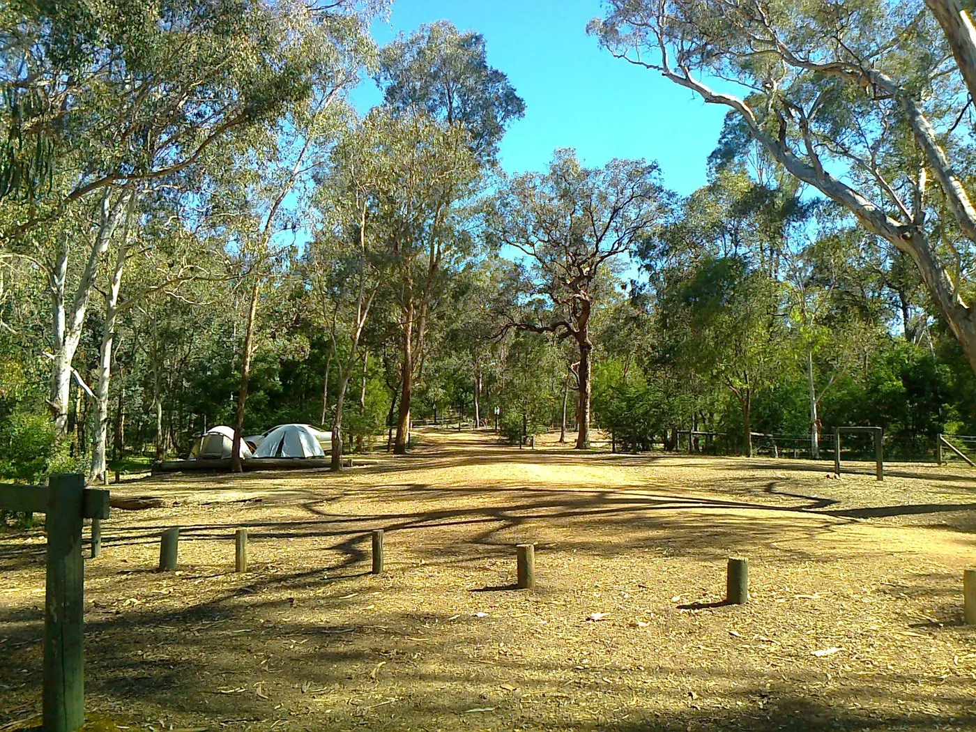
Candlebark Campground, Fraser Block, LNEP · Photo: wanderingchina, CC BY-SA 3.0, via Wikimedia Commons
Map of campgrounds in the High Country
✓ Campgrounds
✓ Things to do
✓ Walks and nature
More around VIC
Camping in Ballarat →
Camping in Bendigo Loddon →
Camping in the Central Murray →
Camping in Geelong and the Bellarine →
Camping in Gippsland →
Camping in Goulburn →
Camping in the Grampians →
Camping in the Great Ocean Road →
Camping in the Lakes →
Camping in Macedon →
Camping in the Mallee →
Camping in Melbourne →
187 campgrounds
Those with the most confirmed facilities first. A missing facility means nobody has confirmed it, not that it is absent.
Campground · Walwa, VIC
Walwa Riverside Caravan Park
Powered sites · Tent sites · Camp kitchen · Laundry · Wi-Fi
Walwa Riverside Caravan Park is a caravan park in Walwa, VIC. OpenStreetMap records 5 facilities. Check availability and current conditions before you travel.
Campground · Bright, VIC
Bright Pine Valley Tourist Park
Powered sites · Tent sites · Wi-Fi
Bright Pine Valley Tourist Park is a caravan park in Bright, VIC. OpenStreetMap records 3 facilities. Check availability and current conditions before you travel.
Campground · Sawmill Settlement, VIC
Carters Mill Campground
Tent sites · Caravan and RV sites · Toilets
Carters Mill Campground is a campground in Sawmill Settlement, VIC. OpenStreetMap records 3 facilities. Check availability and current conditions before you travel.
Campground · Tintaldra, VIC
Clearwater By The Upper Murray Caravan Park
Tent sites · Caravan and RV sites · Camp kitchen
Clearwater By The Upper Murray Caravan Park is a campground in Tintaldra, VIC. OpenStreetMap records 3 facilities. Check availability and current conditions before you travel.
Campground · Porepunkah, VIC
Discovery Parks - Mount Buffalo
Powered sites · Dump point · Wi-Fi
Discovery Parks - Mount Buffalo is a caravan park in Porepunkah, VIC. OpenStreetMap records 3 facilities. Check availability and current conditions before you travel.
Campground · Killawarra, VIC
The Forest Camp
Tent sites · Caravan and RV sites · Toilets
The Forest Camp is a campground near Killawarra, VIC. OpenStreetMap records 3 facilities. Check availability and current conditions before you travel.
Campground · Stanley, VIC
Area No. 1
Tent sites · Caravan and RV sites
Area No. 1 is a campground in Yackandandah, VIC. OpenStreetMap records 2 facilities. Check availability and current conditions before you travel.
Campground · Stanley, VIC
Area No. 2
Tent sites · Caravan and RV sites
Area No. 2 is a campground in Yackandandah, VIC. OpenStreetMap records 2 facilities. Check availability and current conditions before you travel.
Campground · Stanley, VIC
Area No. 3
Tent sites · Caravan and RV sites
Area No. 3 is a campground in Yackandandah, VIC. OpenStreetMap records 2 facilities. Check availability and current conditions before you travel.
Campground · Stanley, VIC
Area No. 4
Tent sites · Caravan and RV sites
Area No. 4 is a campground in Yackandandah, VIC. OpenStreetMap records 2 facilities. Check availability and current conditions before you travel.
Campground · Stanley, VIC
Area No. 6
Tent sites · Caravan and RV sites
Area No. 6 is a campground in Stanley, VIC. OpenStreetMap records 2 facilities. Check availability and current conditions before you travel.
Campground · Mount Bruno, VIC
Black Springs
Tent sites · Caravan and RV sites
Black Springs is a campground in Mount Bruno, VIC. OpenStreetMap records 2 facilities. Check availability and current conditions before you travel.
Campground · Burrowye, VIC
Burrowye Bend - Murray River Reserve
Tent sites · Caravan and RV sites
Burrowye Bend - Murray River Reserve is a campground in Burrowye, VIC. OpenStreetMap records 2 facilities. Check availability and current conditions before you travel.
Campground · Taggerty, VIC
Cooks Mill Campground - Cathedral Range State Park
Tent sites · Wheelchair-accessible paths
Cooks Mill Campground - Cathedral Range State Park is a campground in Taggerty, VIC. OpenStreetMap records 2 facilities. Check availability and current conditions before you travel.
Campground · Rubicon, VIC
Kendalls Camp Area
Tent sites · Caravan and RV sites
Kendalls Camp Area is a campground in Rubicon, VIC. OpenStreetMap records 2 facilities. Check availability and current conditions before you travel.
Campground · Buckland, VIC
New Chum Flat
Tent sites · Caravan and RV sites
New Chum Flat is a campground near Buckland, VIC. OpenStreetMap records 2 facilities. Check availability and current conditions before you travel.
Campground · Jingellic, NSW
Pebble Beach - Murray River Reserve
Tent sites · Caravan and RV sites
Pebble Beach - Murray River Reserve is a campground in Jingellic, NSW. OpenStreetMap records 2 facilities. Check availability and current conditions before you travel.
Campground · Buckland, VIC
Shippens Flat
Tent sites · Caravan and RV sites
Shippens Flat is a campground in Buckland, VIC. OpenStreetMap records 2 facilities. Check availability and current conditions before you travel.
Campground · Rubicon, VIC
The Boys Camping Area
Tent sites · Caravan and RV sites
The Boys Camping Area is a campground near Rubicon, VIC. OpenStreetMap records 2 facilities. Check availability and current conditions before you travel.
Campground · Bright, VIC
Big 4 Bright Holiday Park
Tent sites
Big 4 Bright Holiday Park is a caravan park in Bright, VIC. OpenStreetMap records 1 facility. Check availability and current conditions before you travel.
Campground · Bright, VIC
Bright Riverside Holiday Park
Tent sites
Bright Riverside Holiday Park is a caravan park in Bright, VIC. OpenStreetMap records 1 facility. Check availability and current conditions before you travel.
Campground · Rubicon, VIC
Keppel Creek Camping Area
Tent sites
Keppel Creek Camping Area is a campground in Buxton, VIC. OpenStreetMap records 1 facility. Check availability and current conditions before you travel.
Campground · Tallangatta, VIC
Lakelands Caravan Park
Tent sites
Lakelands Caravan Park is a caravan park in Tallangatta, VIC. OpenStreetMap records 1 facility. Check availability and current conditions before you travel.
Campground · Mansfield, VIC
Mansfield Holiday Park
Tent sites
Mansfield Holiday Park is a caravan park in Mansfield, VIC. OpenStreetMap records 1 facility. Check availability and current conditions before you travel.
Campground · Tawonga South, VIC
Mt Beauty Holiday Centre
Tent sites
Mt Beauty Holiday Centre is a caravan park in Tawonga South, VIC. OpenStreetMap records 1 facility. Check availability and current conditions before you travel.
Campground · Taggerty, VIC
Neds Gully Camping Area
Tent sites
Neds Gully Camping Area is a campground in Taggerty, VIC. OpenStreetMap records 1 facility. Check availability and current conditions before you travel.
Campground · Yea, VIC
Yea Riverside Caravan Park
Tent sites
Yea Riverside Caravan Park is a caravan park in Yea, VIC. OpenStreetMap records 1 facility. Check availability and current conditions before you travel.
Campground · Myrtleford, VIC
Arderns Caravan Park
No facilities confirmed yet.
Arderns Caravan Park is a caravan park in Myrtleford, VIC. Its facilities have not been confirmed. Check availability and current conditions before you travel.
Campground · Stanley, VIC
Area No. 5
No facilities confirmed yet.
Area No. 5 is a campground in Stanley, VIC. Its facilities have not been confirmed. Check availability and current conditions before you travel.
Campground · Beechworth, VIC
Beechworth Holiday Park
No facilities confirmed yet.
Beechworth Holiday Park is a caravan park in Beechworth, VIC. Its facilities have not been confirmed. Check availability and current conditions before you travel.
Campground · Benalla, VIC
Benalla Leisure Park
No facilities confirmed yet.
Benalla Leisure Park is a caravan park in Benalla, VIC. Its facilities have not been confirmed. Check availability and current conditions before you travel.
Campground · Wabonga, VIC
Bennies Campground No 2
No facilities confirmed yet.
Bennies Campground No 2 is a campground in Alpine National Park near Wabonga, VIC, listed by Parks Victoria (2016 listing). Check availability and current conditions before you travel.
Campground · Marysville, VIC
Big River
No facilities confirmed yet.
Big River is a campground in Marysville, VIC. Its facilities have not been confirmed. Check availability and current conditions before you travel.
Campground · Taggerty, VIC
BIG4 Taggerty Holiday Park
No facilities confirmed yet.
BIG4 Taggerty Holiday Park is a caravan park in Taggerty, VIC. Its facilities have not been confirmed. Check availability and current conditions before you travel.
Campground · Mount Buller, VIC
Bindaree Flat Camping Area and DVA
No facilities confirmed yet.
Bindaree Flat Camping Area and DVA is a campground in Alpine National Park near Mount Buller, VIC, listed by Parks Victoria (2016 listing). Check availability and current conditions before you travel.
Campground · Tawonga, VIC
Bivouac Hut camping area
No facilities confirmed yet.
Bivouac Hut camping area is a campground in Alpine National Park near Tawonga, VIC, listed by Parks Victoria (2016 listing). Site has recorded heritage value. Check availability and current conditions before you travel.
Campground · Guys Forest, VIC
Black Mountain trailhead
No facilities confirmed yet.
Black Mountain trailhead is a campground in Burrowa - Pine Mountain National Park near Guys Forest, VIC, listed by Parks Victoria (2016 listing). Check availability and current conditions before you travel.
Campground · Howqua Hills, VIC
Blackbird Flat Campground
No facilities confirmed yet.
Blackbird Flat Campground is a campground in Howqua Hills H.A near Howqua Hills, VIC, listed by Parks Victoria (2016 listing). Check availability and current conditions before you travel.
Campground · Cudgewa, VIC
Blue Gum Camp camping and picnic area
No facilities confirmed yet.
Blue Gum Camp camping and picnic area is a campground in Burrowa - Pine Mountain National Park near Cudgewa, VIC, listed by Parks Victoria (2016 listing). Check availability and current conditions before you travel.
Campground · Cudgewa, VIC
Bluff Falls Camping Area
No facilities confirmed yet.
Bluff Falls Camping Area is a campground in Cudgewa, VIC. Its facilities have not been confirmed. Check availability and current conditions before you travel.
Campground · Mount Beauty, VIC
Bogong Creek Huts Camping Area
No facilities confirmed yet.
Bogong Creek Huts Camping Area is a campground in Alpine National Park near Mount Beauty, VIC, listed by Parks Victoria (2016 listing). Check availability and current conditions before you travel.
Campground · Falls Creek, VIC
Bogong Jack Saddle Camping Area
No facilities confirmed yet.
Bogong Jack Saddle Camping Area is a campground near Falls Creek, VIC. OpenStreetMap records 0 facilities. Check availability and current conditions before you travel.
Campground · Bonnie Doon, VIC
Bonnie Doon Caravan Park
No facilities confirmed yet.
Bonnie Doon Caravan Park is a caravan park in Bonnie Doon, VIC. Its facilities have not been confirmed. Check availability and current conditions before you travel.
Campground · Bright, VIC
Bright Cabin & Caravan Park
No facilities confirmed yet.
Bright Cabin & Caravan Park is a caravan park in Bright, VIC. Its facilities have not been confirmed. Check availability and current conditions before you travel.
Campground · Burrowye, VIC
Bullock Flat camping and picnic area
No facilities confirmed yet.
Bullock Flat camping and picnic area is a campground in River Murray Reserve near Burrowye, VIC, listed by Parks Victoria (2016 listing). Check availability and current conditions before you travel.
Campground · Brimin, VIC
Bundalong Caravan Park
No facilities confirmed yet.
Bundalong Caravan Park is a caravan park in Brimin, VIC. Its facilities have not been confirmed. Check availability and current conditions before you travel.
Campground · Biggara, VIC
Bunroy Creek camping and picnic area
No facilities confirmed yet.
Bunroy Creek camping and picnic area is a campground in River Murray Reserve near Biggara, VIC, listed by Parks Victoria (2016 listing). Check availability and current conditions before you travel.
Campground · Biggara, VIC
Bunroy Station trailhead
No facilities confirmed yet.
Bunroy Station trailhead is a campground near Biggara, VIC, listed by Parks Victoria (2016 listing). Check availability and current conditions before you travel.
Campground · Falls Creek, VIC
Campbell's Yard Huts Camping
No facilities confirmed yet.
Campbell's Yard Huts Camping is a campground in Alpine National Park near Falls Creek, VIC, listed by Parks Victoria (2016 listing). Check availability and current conditions before you travel.
Campground · Bridge Creek, VIC
Camphora Campsite
No facilities confirmed yet.
Camphora Campsite is a campground in Mount Samaria State Park near Bridge Creek, VIC, listed by Parks Victoria (2016 listing). Check availability and current conditions before you travel.
Campground · Mount Buller, VIC
Camping 7 Mile Flat
No facilities confirmed yet.
Camping 7 Mile Flat is a campground in Alpine National Park near Mount Buller, VIC, listed by Parks Victoria (2016 listing). Check availability and current conditions before you travel.
Campground · Mount Buller, VIC
Camping 8 Mile Flat
No facilities confirmed yet.
Camping 8 Mile Flat is a campground in Alpine National Park near Mount Buller, VIC, listed by Parks Victoria (2016 listing). Check availability and current conditions before you travel.
Campground · Caveat, VIC
Camping Bays
No facilities confirmed yet.
Camping Bays is a campground in Caveat, VIC. Its facilities have not been confirmed. Check availability and current conditions before you travel.
Campground · Cornishtown, VIC
Camping Ground - Tuan Camping Area - Chiltern Mt Pilot National Park
No facilities confirmed yet.
Camping Ground - Tuan Camping Area - Chiltern Mt Pilot National Park is a campground in Chiltern-Mt Pilot National Park near Cornishtown, VIC, listed by Parks Victoria (2016 listing). Check availability and current conditions before you travel.
Campground · Devils River, VIC
Candlebark Campground, Fraser Block, LNEP
No facilities confirmed yet.
Candlebark Campground, Fraser Block, LNEP is a campground in Lake Eildon National Park near Devils River, VIC, listed by Parks Victoria (2016 listing). Check availability and current conditions before you travel.
Campground · Enochs Point, VIC
Chaffe Creek Campsite
No facilities confirmed yet.
Chaffe Creek Campsite is a campground near Enochs Point, VIC. OpenStreetMap records 0 facilities. Check availability and current conditions before you travel.
Campground · Dargo, VIC
Christie O'Rourkes Camping Area
No facilities confirmed yet.
Christie O'Rourkes Camping Area is a campground in Alpine National Park near Dargo, VIC, listed by Parks Victoria (2016 listing). Check availability and current conditions before you travel.
Campground · Tintaldra, VIC
Clarke Lagoon camping and picnic area.
No facilities confirmed yet.
Clarke Lagoon camping and picnic area. is a campground in River Murray Reserve near Tintaldra, VIC, listed by Parks Victoria (2016 listing). Check availability and current conditions before you travel.
Campground · Colac Colac, VIC
Colac Colac Caravan Park
No facilities confirmed yet.
Colac Colac Caravan Park is a caravan park in Colac Colac, VIC. Its facilities have not been confirmed. Check availability and current conditions before you travel.
Campground · Bungil, VIC
Conic Range picnic area
No facilities confirmed yet.
Conic Range picnic area is a campground in Mount Lawson State Park near Bungil, VIC, listed by Parks Victoria (2016 listing). Check availability and current conditions before you travel.
Other regions in Victoria
Region boundary: ABS ASGS Edition 3 Tourism Regions 2021 (Tourism Research Australia), CC BY 4.0. Campgrounds and facilities from OpenStreetMap contributors (ODbL), the operators’ own listings, and the state park services’ open data: © State Government of NSW and NSW Department of Climate Change, Energy, the Environment and Water 2017 (CC BY 4.0); contains data sourced from the Department of Energy, Environment and Climate Action, Victoria (CC BY 4.0); © State of Tasmania, Parks and Wildlife Service (CC BY 3.0 AU); Main Roads Western Australia road stopping places (CC BY 4.0).